The Garibaldi at Squamish Project
The Garibaldi at Squamish project is a proposed year-round mountain resort on Brohm Ridge. The project proponents, Northland Properties Approval and Aquilini Investment Group of Vancouver, originally proposed the project in 1997 for a Project Approval Certificate from the Environmental Impact Assessment. The Environmental Impact Assessment concluded that the project lacked information regarding the impact on vegetation, fish, and wildlife habitat. The Impact Assessment Agency recommended measures to prevent or reduce significant environmental, social, economic, heritage, and health effects. In 2015, the project proponents submitted another application, claiming that it accounted for the issues. The approved project is located 15 km north of Squamish, 80 km north of Vancouver, and 45 km south of Whistler. The approved project will include 124 ski trails, 21 lifts, multipurpose hiking and biking trails, a car-free village, resort accommodation and commercial developments. The process of developing the project and operation is expected to create 900 construction jobs and 2500 jobs.
Areas at Risk for the Proposed Project Boundary
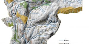
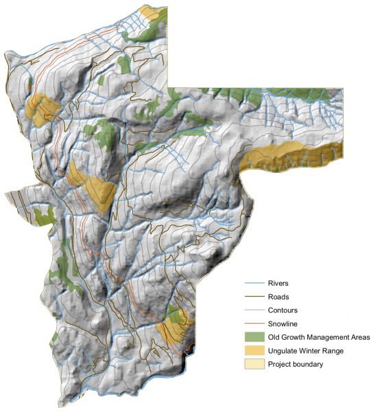
During the two month public consultation (from May to June), the Resort Municipality of Whistler submitted a letter concerning the economic viability and impact of the project. They specified on the 1974 report that states “climatological considerations rule out reliable skiing on the lower 555m of vertical”. As shown in the map, areas above the snowline are 555m and above; under the snowline is below 555m. Streams above the snowline are less likely to be fish bearing so they are given a 50m buffer whereas streams below the snowline are given a 100m buffer.
I have also mapped areas that will be affected by the project within the project boundaries. This includes old growth management areas, fish habitat riparian zones, and ungulate habitat areas. In conclusion, I have found that these protected areas make up 38% of the Garibaldi project. This means around 5,173 acres of land is protected within the 13,521 acres of the Garibaldi project boundary.

| Areas of Concern | Percentage of Area within Boundary | Area of land (acres) |
| Old Growth Management Areas | 6.8% | 916.84 |
| Ungulate Habitat Areas | 7.9% | 1066.3 |
| Fish Habitat Riparian Zones | 28% | 3788.88 |
Personal Opinion and Suggestions
Personally, I do not see a reason for another mountain resort when Whistler is 45 km away. An extra 1 hour drive would be more reasonable than disrupting natural environments for human entertainment. Whistler offers about the same services as the approved Garibaldi project. However, the project has been approved. My hopes for the process of development for this project to be mindful of these protected areas. Nonetheless, unprotected areas should also be accounted for because these areas are still homes to many species. I recommend that the project limit their disturbance to these ecosystems as much as possible. Some ways of minimizing impact on the ecosystem is by reviewing the development and operation methods and monitoring the patterns and change in the area.
Errors and Uncertainty
- reliability of data sources
- Areas shown on map are not exact as some species may move (by own trait or human influence); it does not pinpoint the exact location of species, assuming that they stay in one area or confined in a specific area
New Skills Acquired
- Acquired data from DataBC and TRIM data for an environment impact assessment.
- Parsed data to categorize and organize data.
- Filtered data by clipping raster and vector files to the project boundary, removing unnecessary areas that are beyond the project boundary.
- Reclassified DEM to the 555m elevation which is the minimum elevation requirement for skiing.
- Calculated the areas of polygons (old growth forests, ungulate winter range, and fish habitat/riparian areas) to determine the percentage that these areas occupy within the project boundaries.
- Created a 3D Hillshade map.
Learning Significance